Here I am posting my latest research on the possible locations and borders of the ten nations of Atlantis as described by Plato. People ask me where I think Atlantis existed. A better question is where it didn’t exist. According to Plato, Atlantis was a ten nation empire that covered two continents the size of Asia and ancient Libya combined. Ancient Libya at the time of Plato covered almost a third of Africa. According to Plato, this massive double continent “island” was surrounded by an ocean so vast it made the Mediterranean look like a bay. Plato goes on to imply that some of the nations occupied islands east of this massive double continent. The Rome-like capital of this enormous empire- Poseidon- was so large that Pennsylvania, Maryland, New Jersey, Delaware, and Vermont could have fit within its city limits with room left over. Again according to Plato it was this massive capital- Poseidon- that sank beneath the waves, not the empire. Everything else I believe was crushed, burned, drowned, buried, or vaporized during the cataclysmic end of the Second Age when the poles were toppled and the oceans raised 800 feet during a violent upheaval possibly involving meteor strikes, 2000 foot high tidal waves, massive earthquakes, and multiple volcanic eruptions that made Krakatoa look like a camp fire.
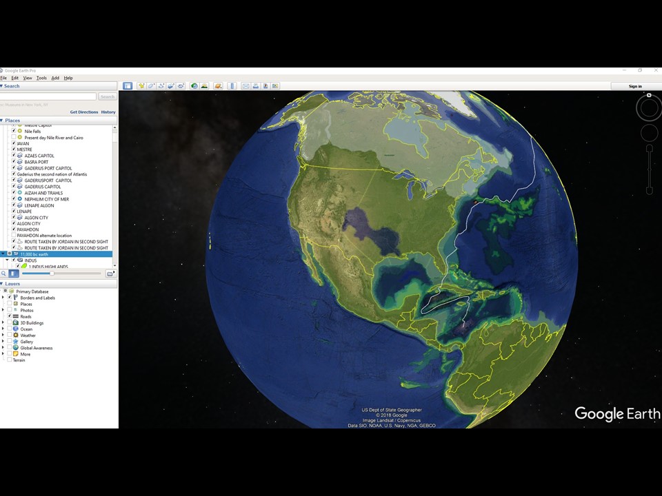
I believe six of the ten nations of Atlantis are buried 300 hundred to 1000 feet beneath North, Central, South America, and Antarctica. Antarctica was ice free and attached to South America at the time Plato says Atlantis existed. (9000 BCE) I believe the empire’s capital- Poseidon- lies drowned beneath the sands of the Caribbean south of Cuba and east of Mexico.
I will draw each of the nations of Atlantis and post them here.
Thanks for reading !
Jack
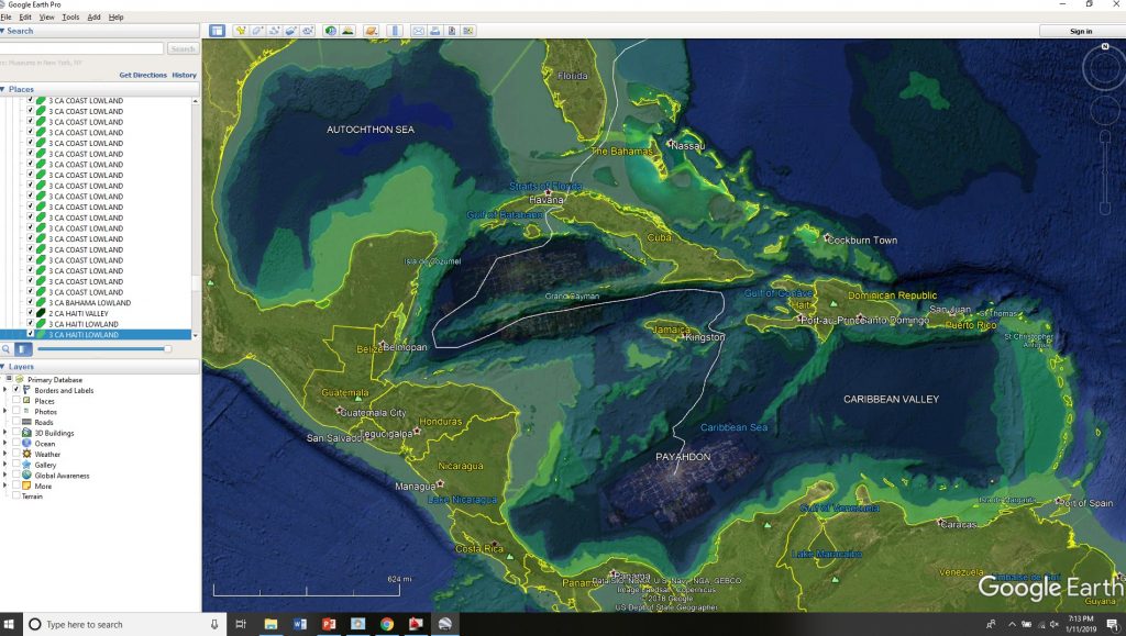
Ancient Imperial Capitol Poseidon currently lies buried under hundreds of feet of Sahara blown sand beneath the Caribbean Sea, south of the Yucatan Peninsula and north of Columbia. The enormous city spans an area as large as half of Florida. It rests on a flat, oblong plain surrounded by mountain ridges that are also completely submerged. The remains of an extensive submerged canal runs from a point either along the South American coast line or from between the British Virgin Islands and the Barracuda Bank, through the Ginger Basin.
More likely both were active canal systems during the time that the Caribbean was a valley.
More city ruins can be found submerged south of Cuba and south of the Cayman Islands ridge.
All are buried beneath hundreds of feet of sand. The oil percolating out of these sand banks are the vegetative, animal, and human remains that continue to decompose after this area flooded in 11,270 BCE. I am assigning this date assuming an error of plus or minus 264 years based on comparison of Manetho dating, the end of the This Dynasty in 11,542 BCE, the closest Mayan b’ak’tun Calendar restart in 10,999 BCE, and the general modern estimate of the end of the Pleistocene Ice Age in 11,700 BCE.
If we use just the This Dynasty 11,542 BCE and the Mayan b’ak’tun 10,999 BCE dates, then the date adjusts to 11,621 BCE. This may be the more accurate date given the vagueness of the modern dating estimate.
The ancient circular city mentioned in Plato’s writings is the old city center of Poseidon. I have located the probable center of this ringed city based on the intersection of projected lines from El Candelabra and the Giza monuments. I would suggest a search start at West 77 degrees, 30 minutes / North 12 degrees, 30 minutes. Given the recorded opulence of the ancient ringed city and the likely density of surrounding structures that would have grown up around that point, there should be higher chances of finding architectural remains starting at this point and grid searching along a track northeastward and southwestward as this would follow the probably canal route before it deviated either north or south east to reach natural gaps in the submerged mountain ridges protecting this region from the Atlantic Ocean.