2019 1 29 Reference Slides for 1210 AM talk radio discussion with Bradley E. Lacey
Second Sight and Second Birth are historical fiction based on the author’s theories about the times and tumult of the Second Age, the Age of Atlantis
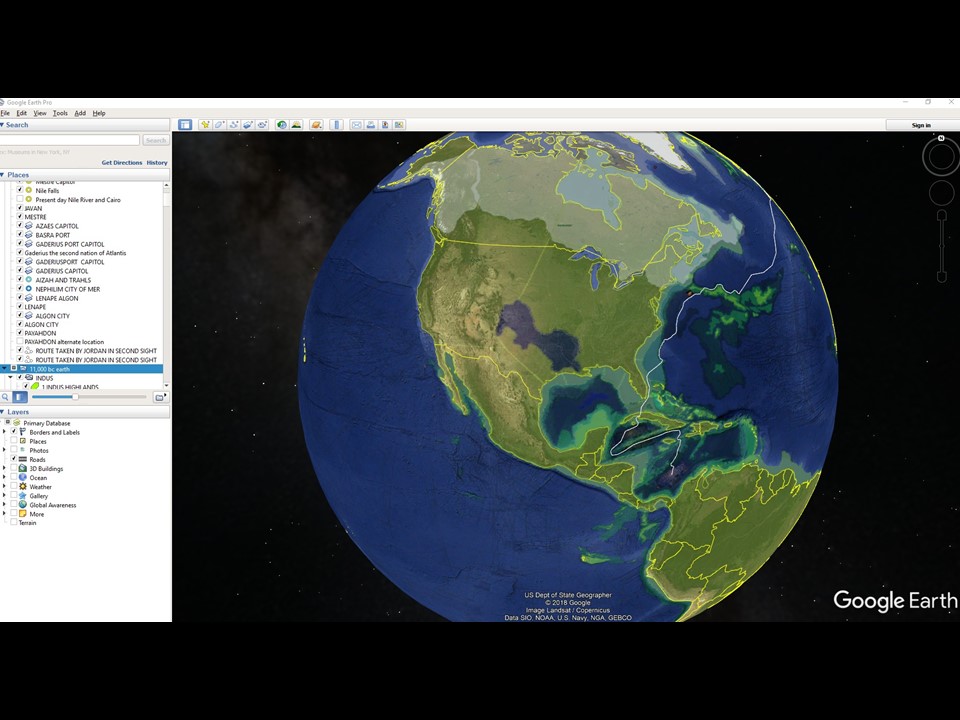
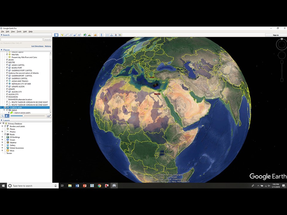
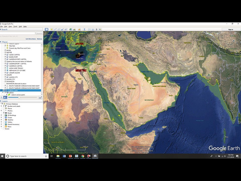
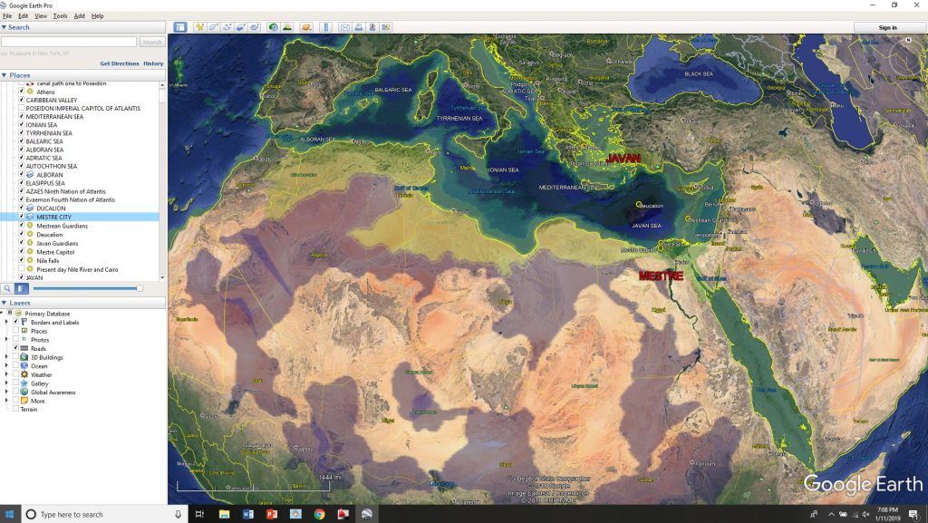
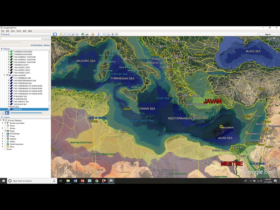
The world as it may have looked at the time of Atlantis
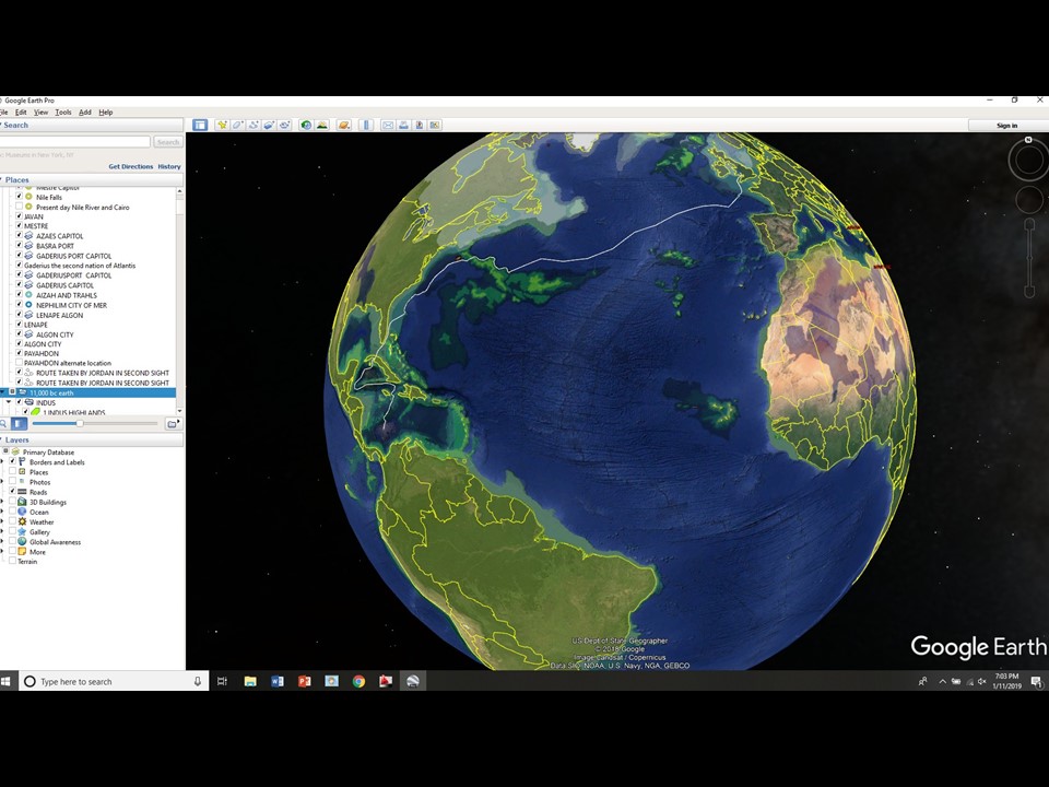
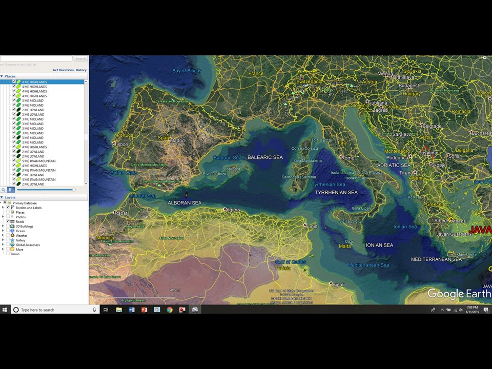
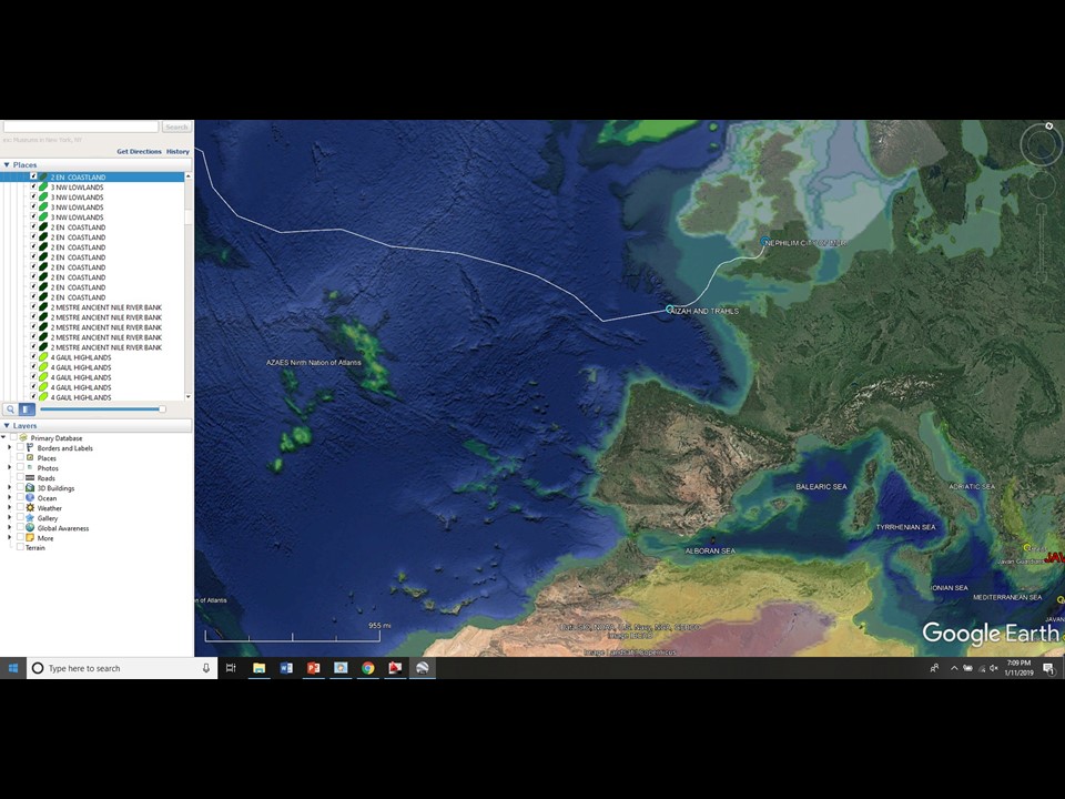
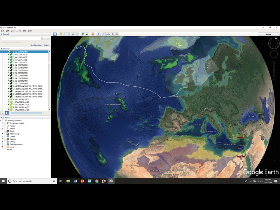
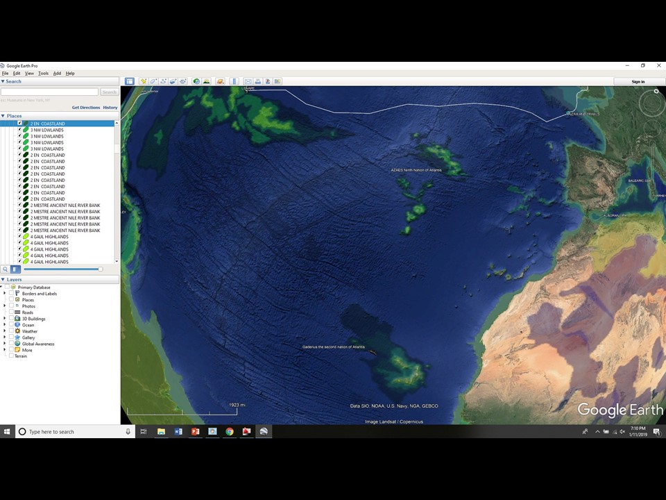
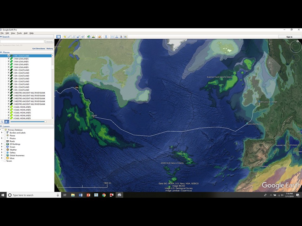
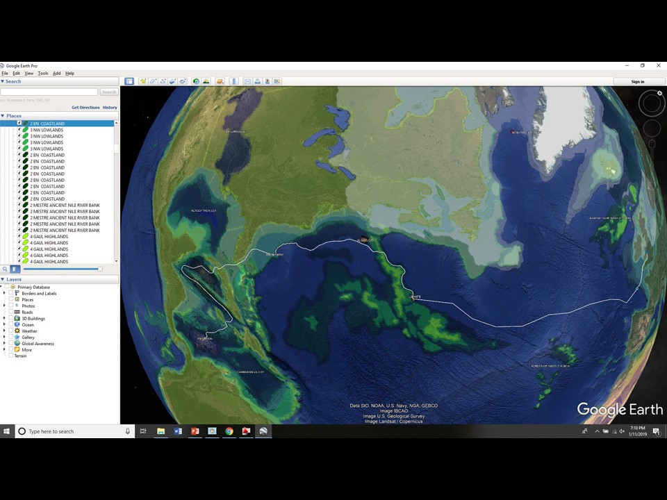
13,000 years ago a network of seas laced across what is the Sahara today. These seas emptied into the Mediterranean Valley down a series of enormous one mile waterfalls.The white line is the route Jordan and Suri took east across the Atlantis Ocean as they fled Atlantis in the early chapters of Second Sight.Much more land existed in the Atlantic during the Second Age. It would have been much easier to navigate the Atlantic in those days then today.
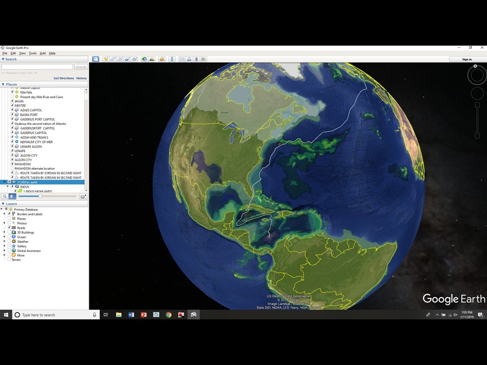
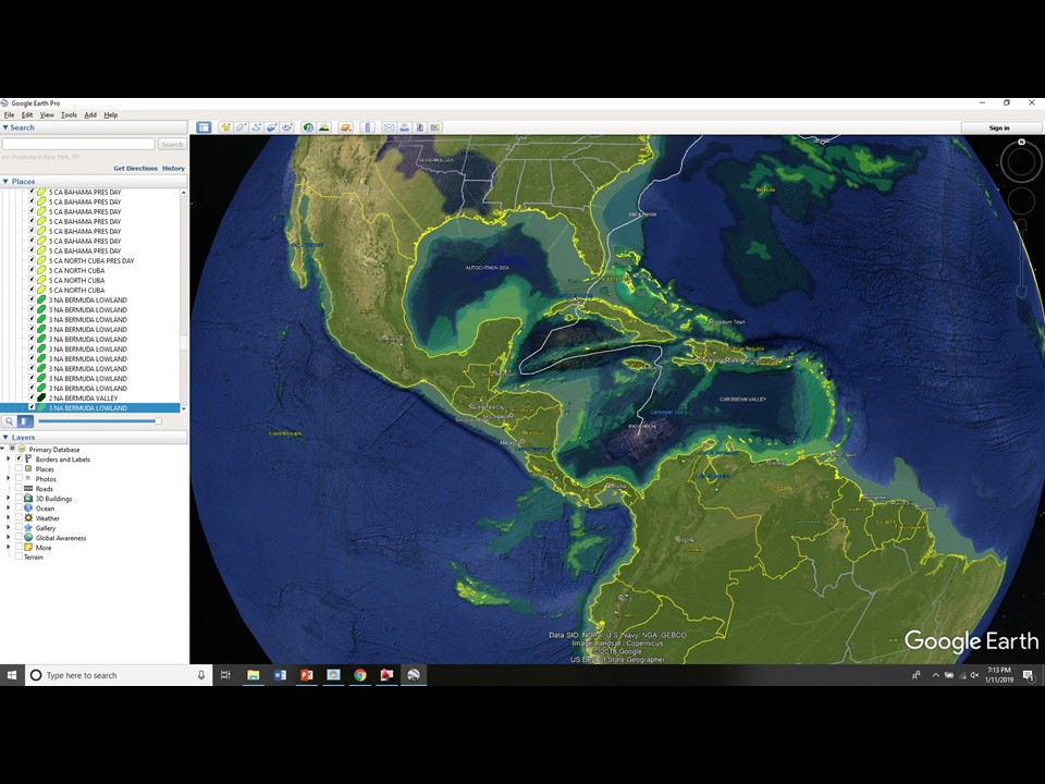
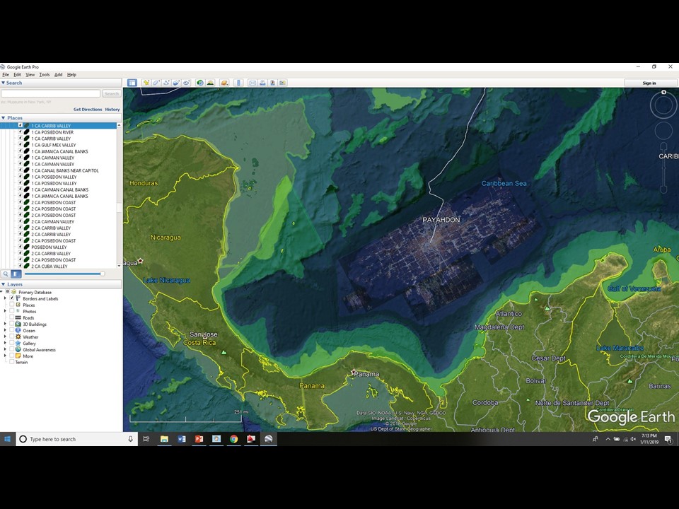
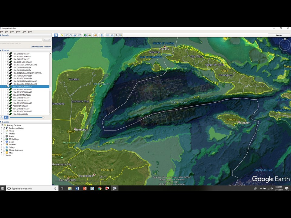
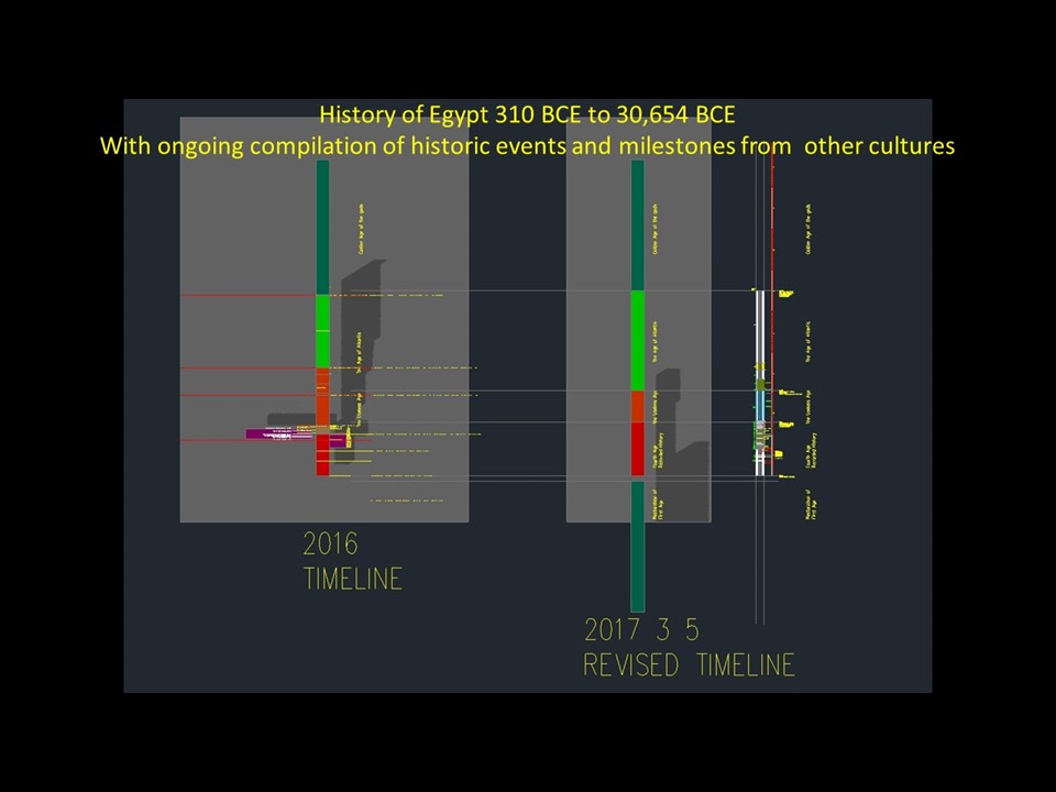
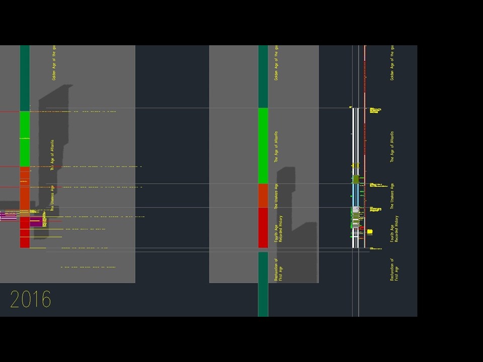
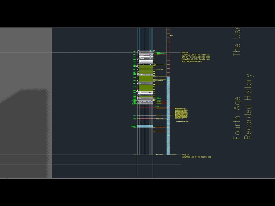
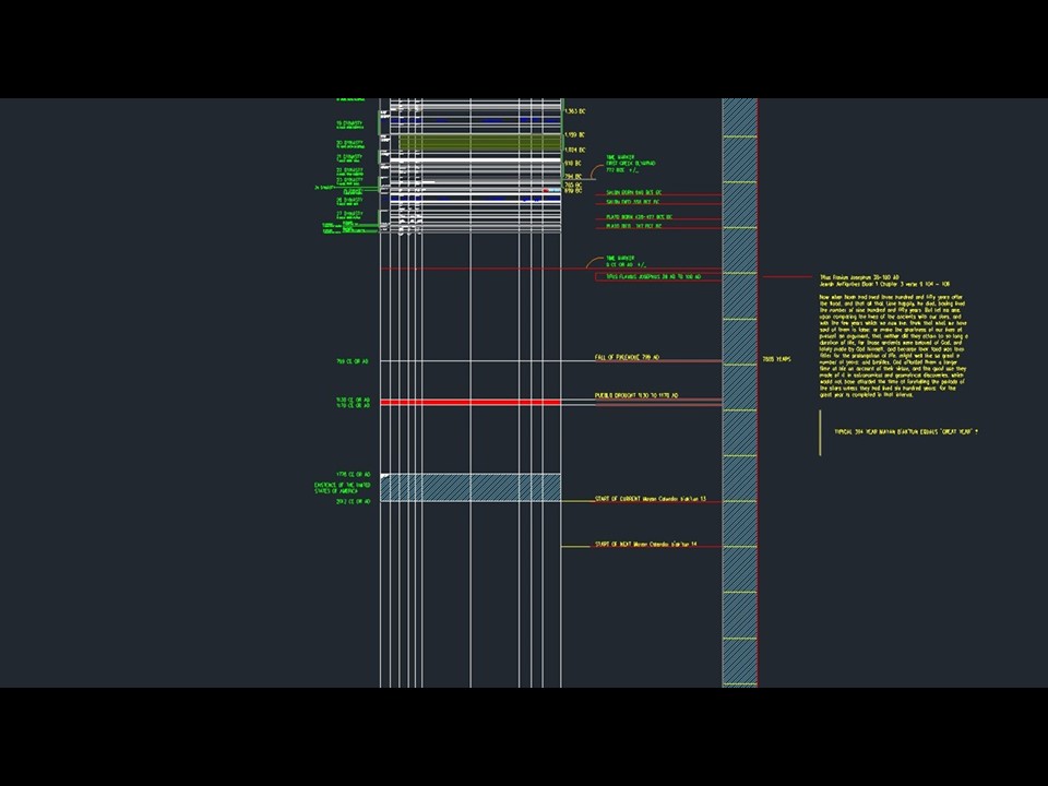
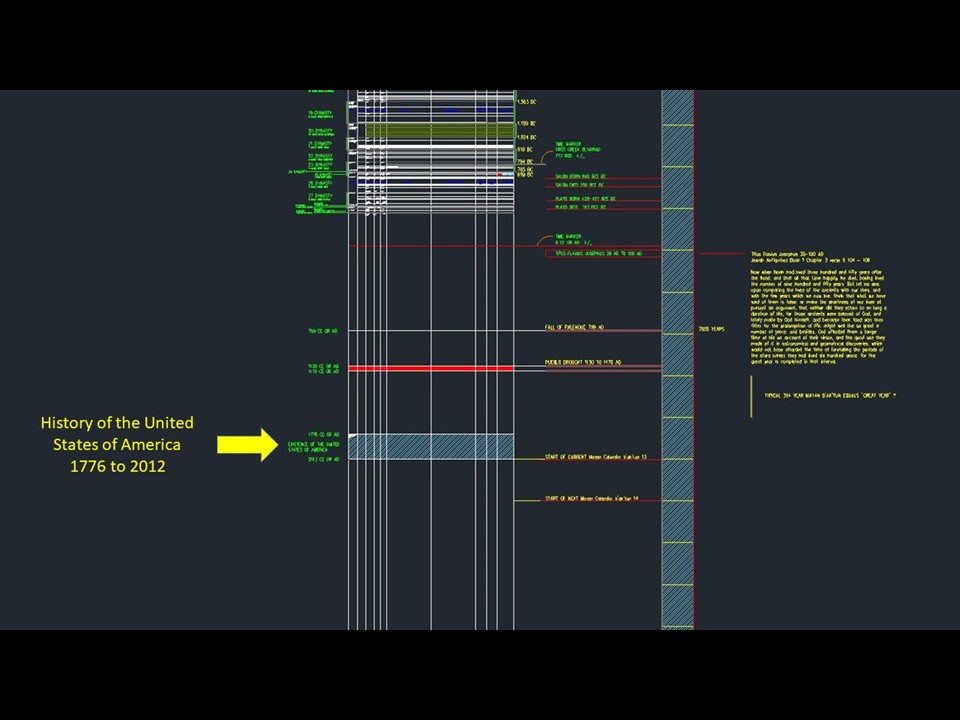
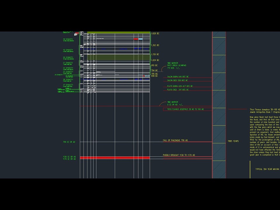
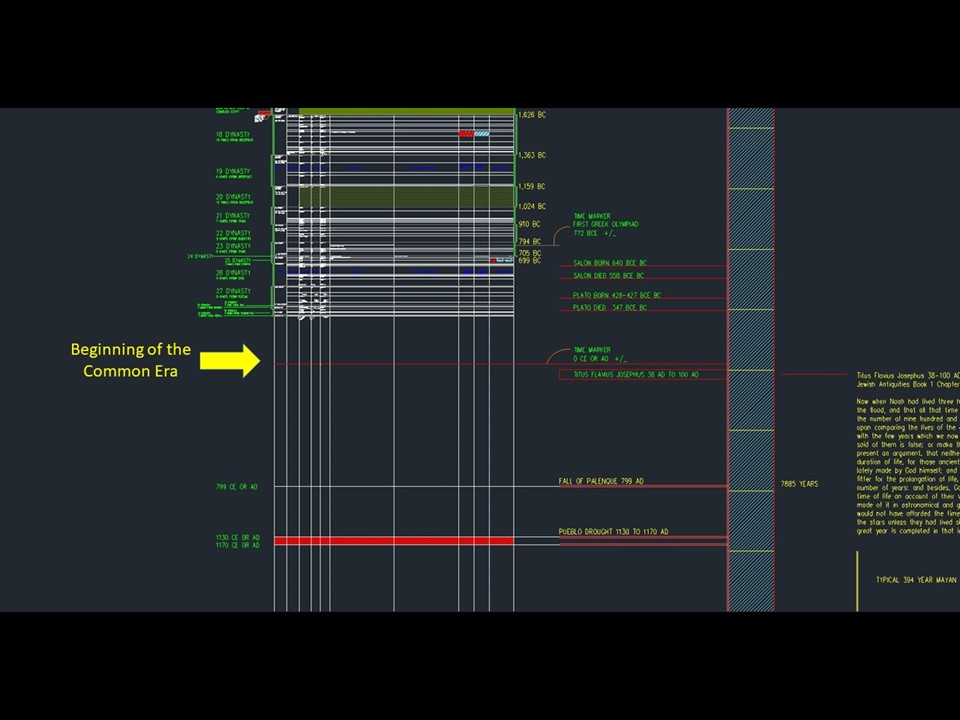
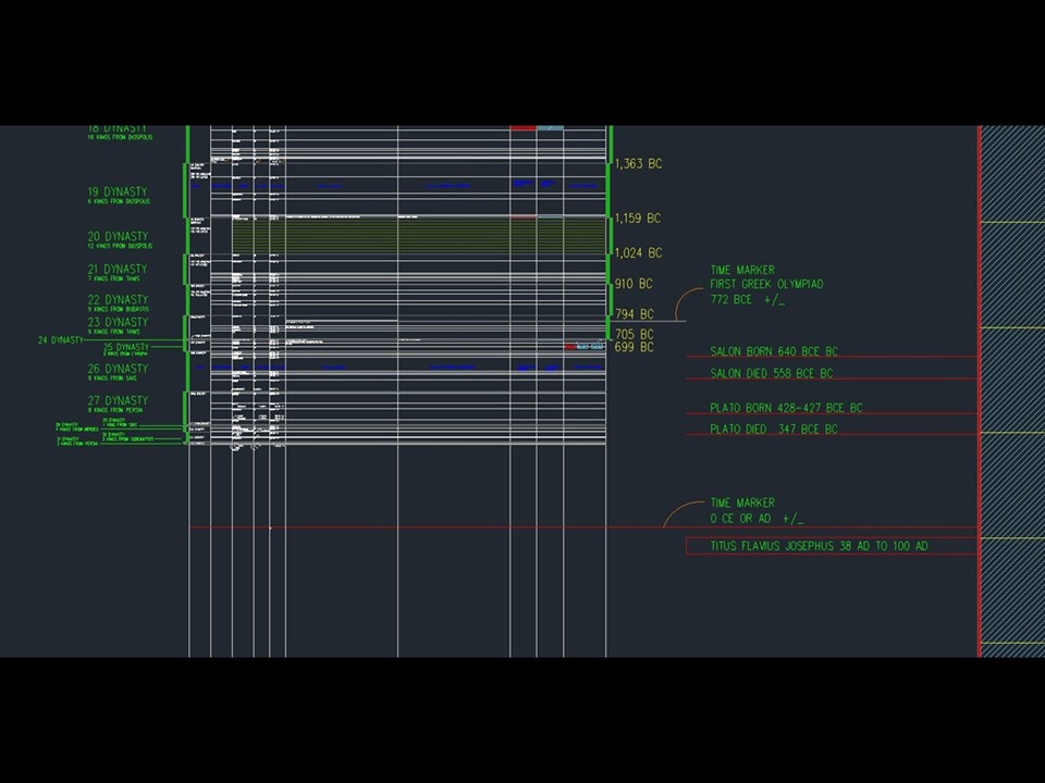
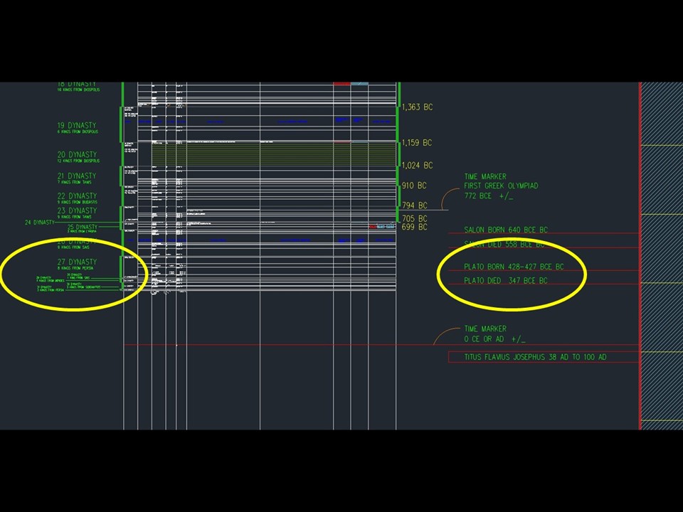
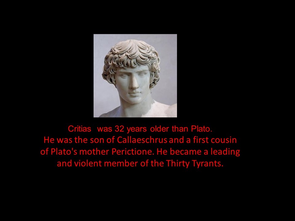
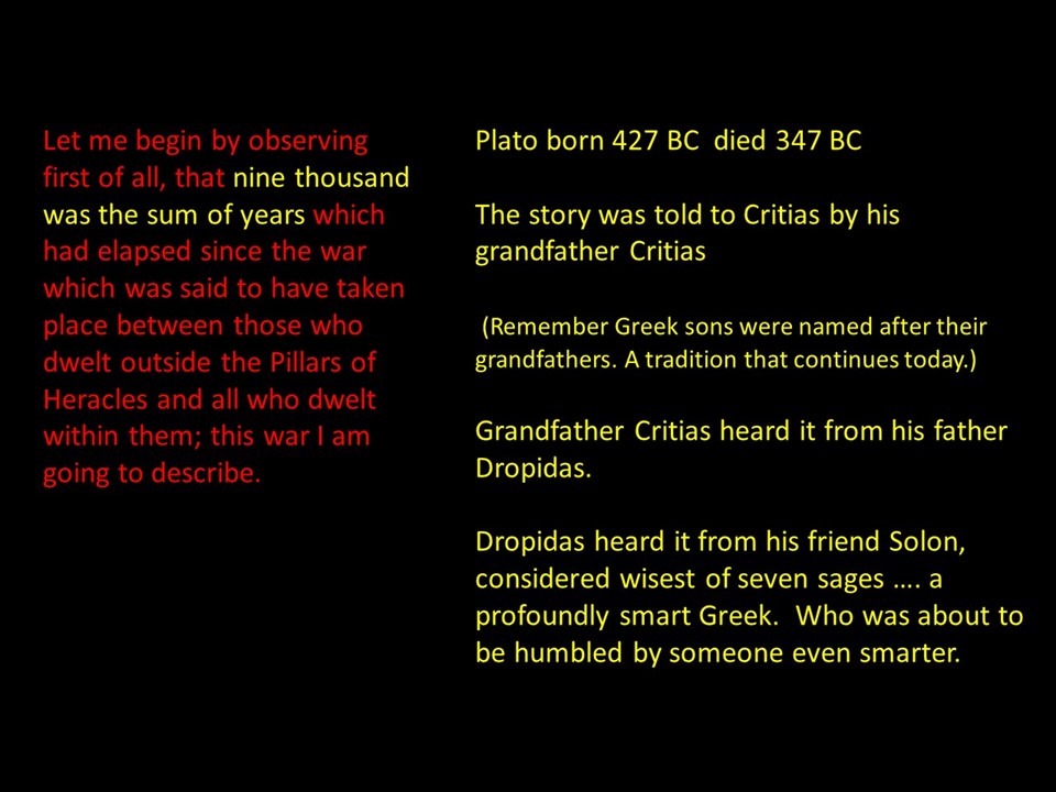
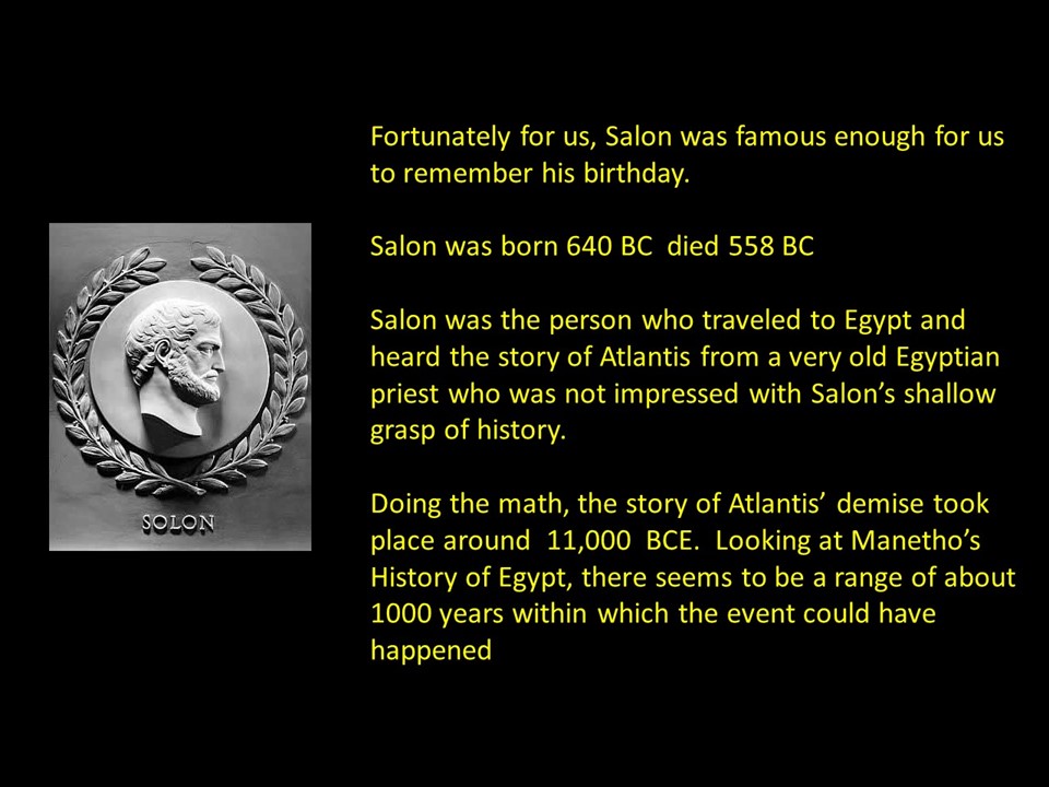
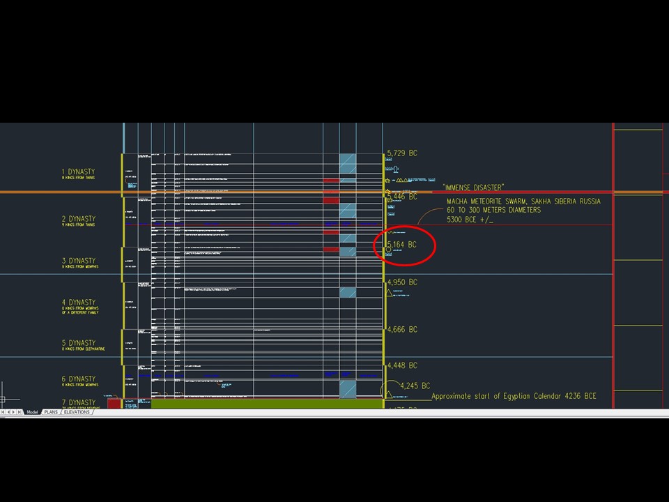
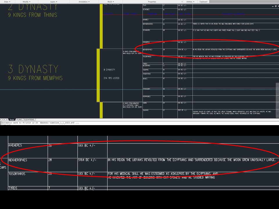
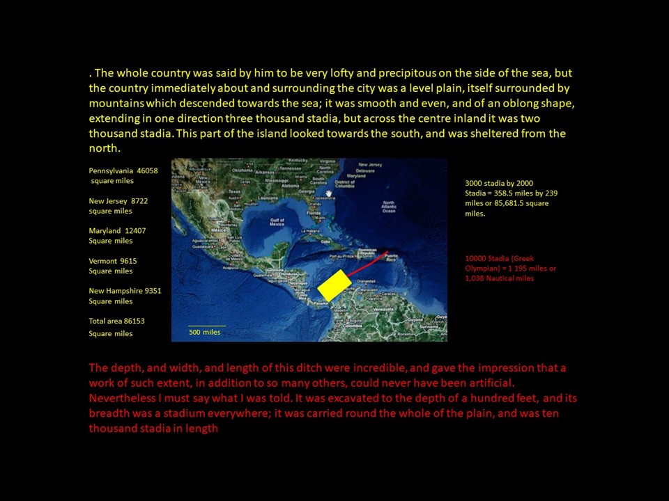
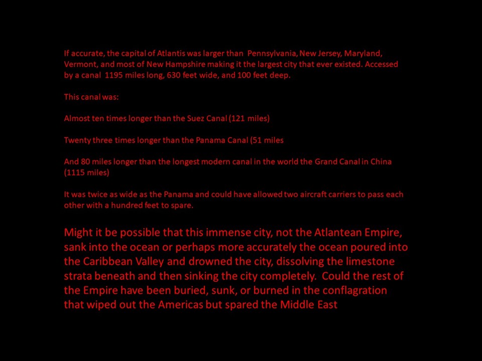
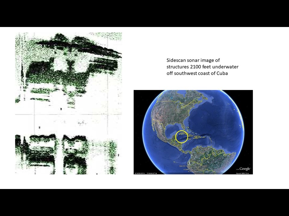
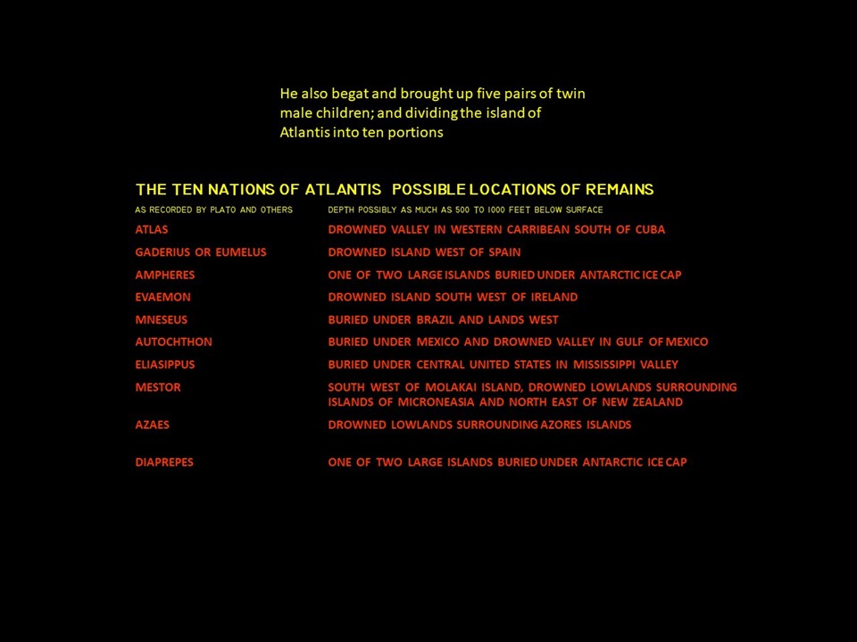
The north pole was located near the southwestern edge of Greenland. This caused the zodiac to align with the equator. Future America was sub-arctic. The world was knocked off its axis at the end of the Second Age, moving the pole to its present location. That disastrous event plays out in Second Birth. The heart of the Atlantean Empire was a protected series of plateaus, protected by mountain chains whose peaks form the Caribbean Islands. Access to the Imperial Capitol of Atlantis was via an enormous canal wide enough and deep enough to allow two modern day aircraft carriers to pass each other with ease. Ten nations comprised Atlantis. Atlas was the first nation and where the Imperial Capitol Poseidon was located. Plato described Poseidon as being the largest city that ever existed. Its ports were in operation day and night. Poseidon was located on a flat plain surrounded by mountains. Both the plain and the mountains vanished in a single day, drowned by catastrophic rising ocean levels at the end of the Second Age. Poseidon was so large that the entire state of Georgia or Alabama could have fit within its city limits. Underwater side scan sonar studies have uncovered structures in the Gulf of Mexico too. Every time a hurricane scours the sand away in the Gulf or the Caribbean, airline pilots have sometimes been able to observe ruins temporarily exposed in the storm’s wake. At the center of this image is where the massive Canal may have extended from the Atlantic westward into the heart of the Empire.This was the title slide I used for talks at various schools this year. Much of my work is linked together by a history of Egypt written by the last priest of Egypt Manetho who held office during the invasion of Egypt by the Greeks and the Macedonians. He was the one who translated Egyptian history into Greek onto scrolls for Alexander the Great. The location of Manetho’s Library of Egypt has never been found. This timeline is drawn in AutoCad and if printed on paper would stretch two and a half miles in width and a mile and a half in length. Every Pharaoh who reigned in Egypt is listed, going back beyond 34,000 BCE . I have overlaid other cultures on top of Manetho’s work including Maya, Inca, Chinese, and any ancient disasters any of the four cultures recorded. I’m going to zoom in now to show more detail. As of this writing, I am well beyond 30,654 BC now thanks to new correlations with the Inca and the Jewish historical narratives. Now we will go back in time from present day, past Plato, and into the deep past of AtlantisYear ZeroPlato and Solon, births and deaths. if it wasn’t for Plato’s single recorded discussion about Solon’s visit to Egypt where he learned of Atlantis, we would have no record of an enormous piece of human history. Only time boundaries indicating something disastrous happened to the human race, catastrophically changing us forever. I strongly suggest you purchase a used copy of this book. His rendition is straight Plato without embellishment or interpretation. Critias relayed Solon’s story to PlatoHere is the entire discussion. They intended to continue but political troubles in the city drew Critias away before he could complete the story. He never returned or if he did, the record of what was discussed did not survive the Ages.I strongly suggest you take the time to read this slowly.
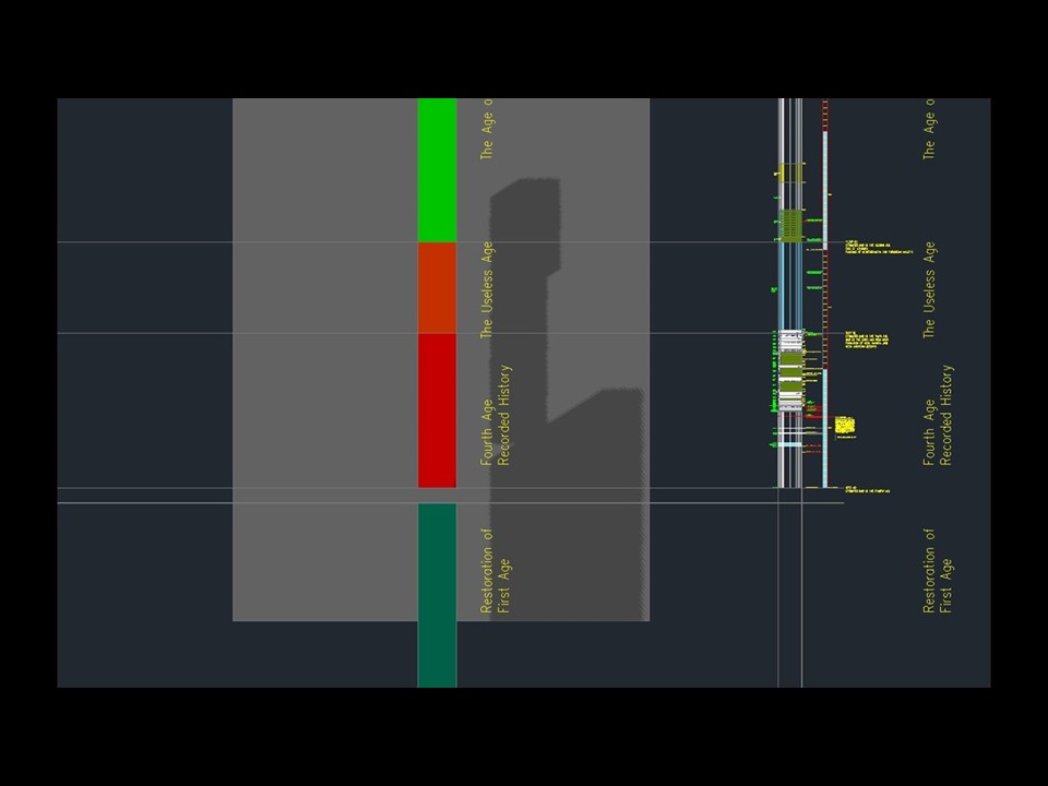
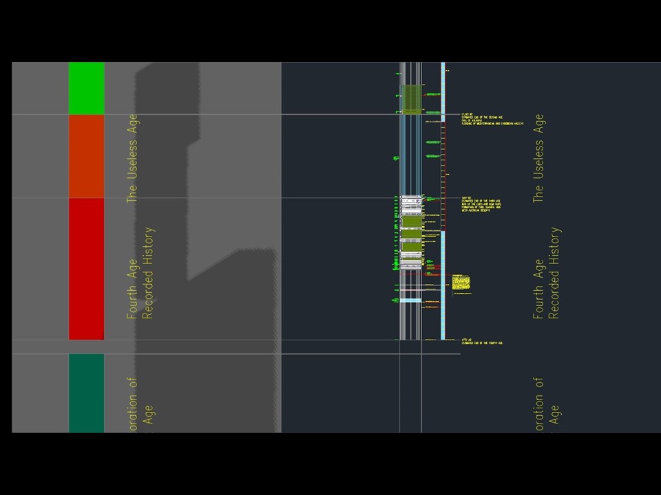
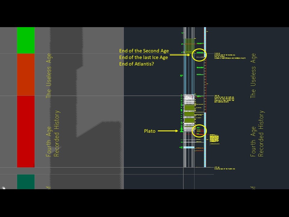
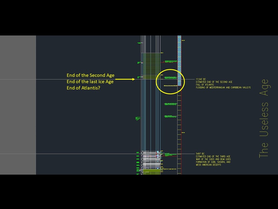
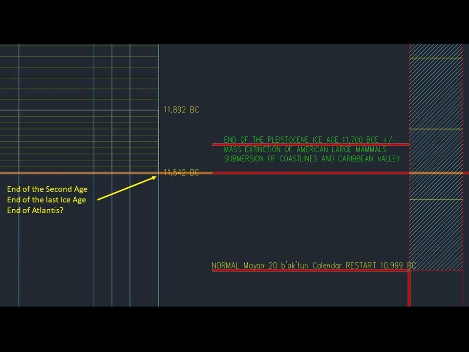
Going back to the timeline, the end of Atlantis appears at a point where a lot of history is being recorded, followed by a long blank space of nothing recorded for thousands of years. The Maya called this period the Useless Age. Then civilization appears to reboot and all of the Egyptian Dynasties chug along with natural disasters, celestial events, and sudden changes in climate taking place.
A lot of civilizations around the world seemed to have suddenly stopped the same time Atlantis ended, and then slowly rebooted.
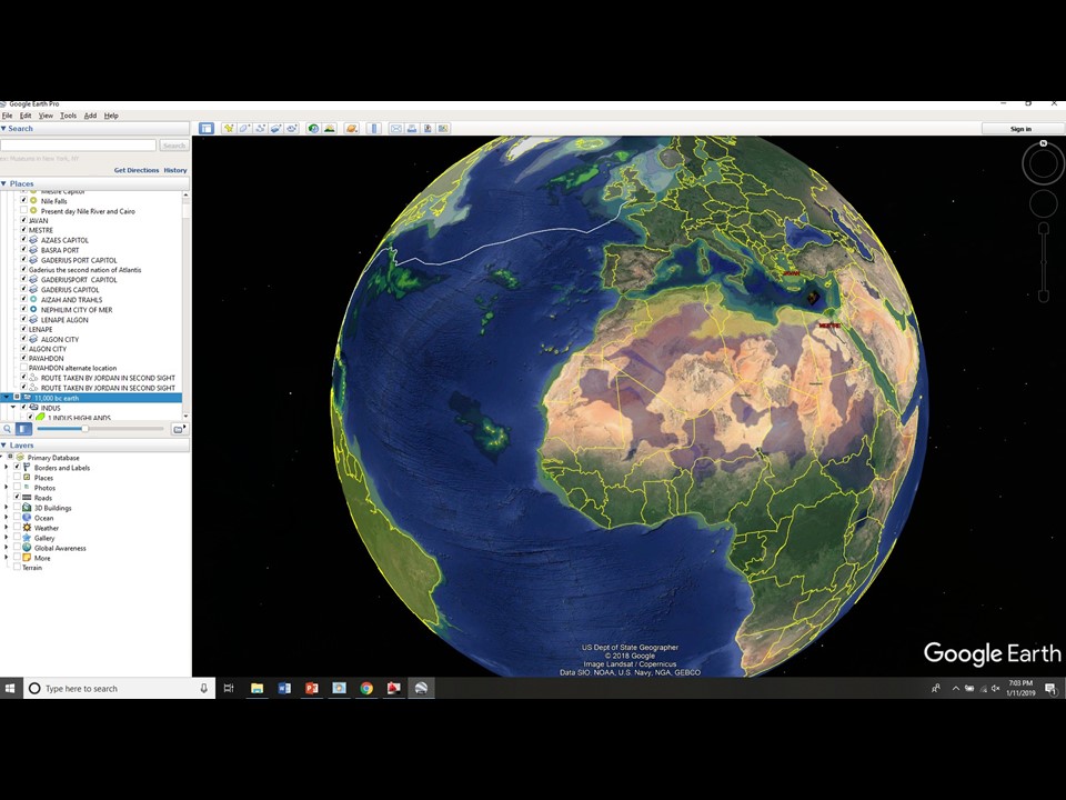
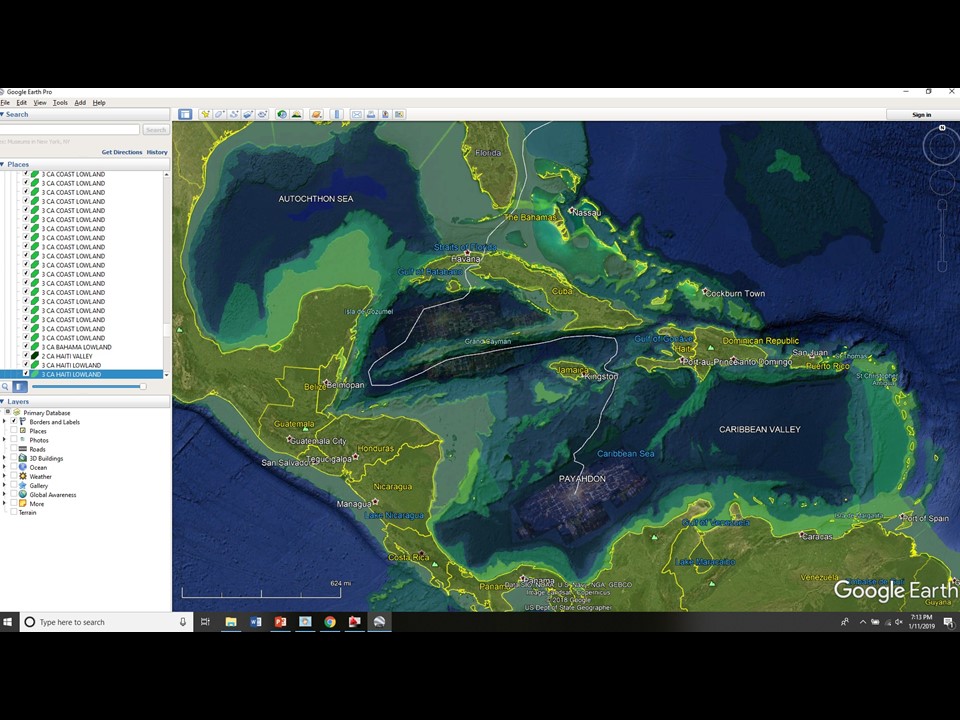
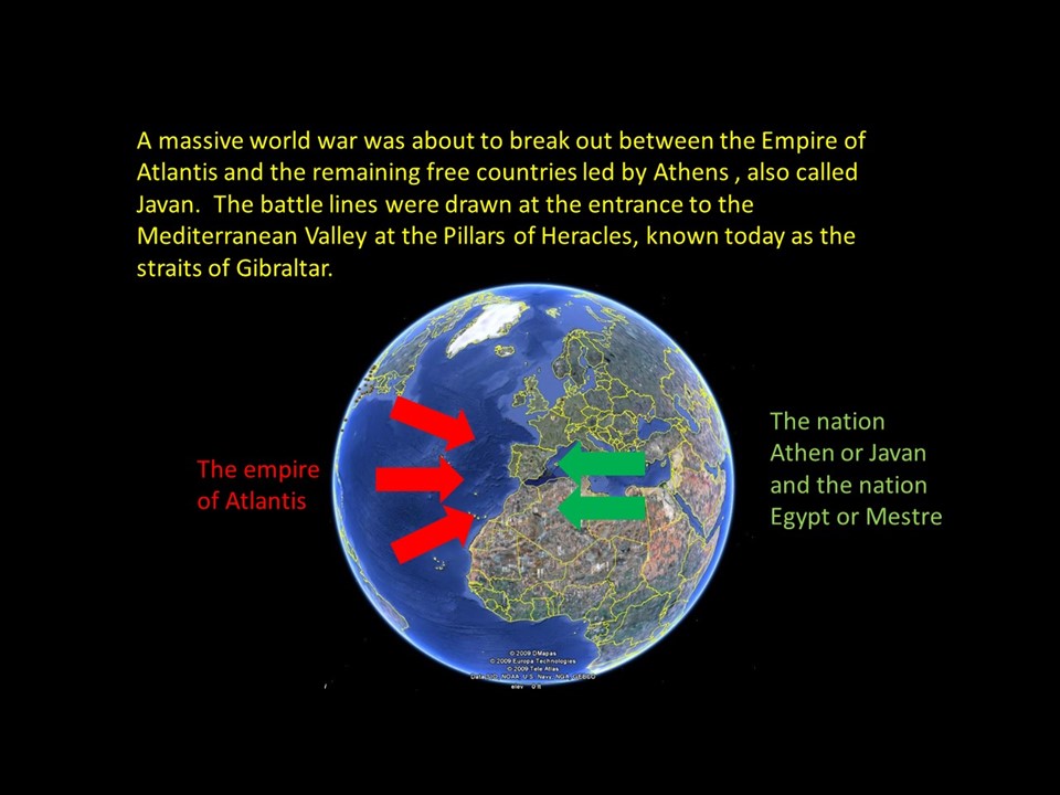
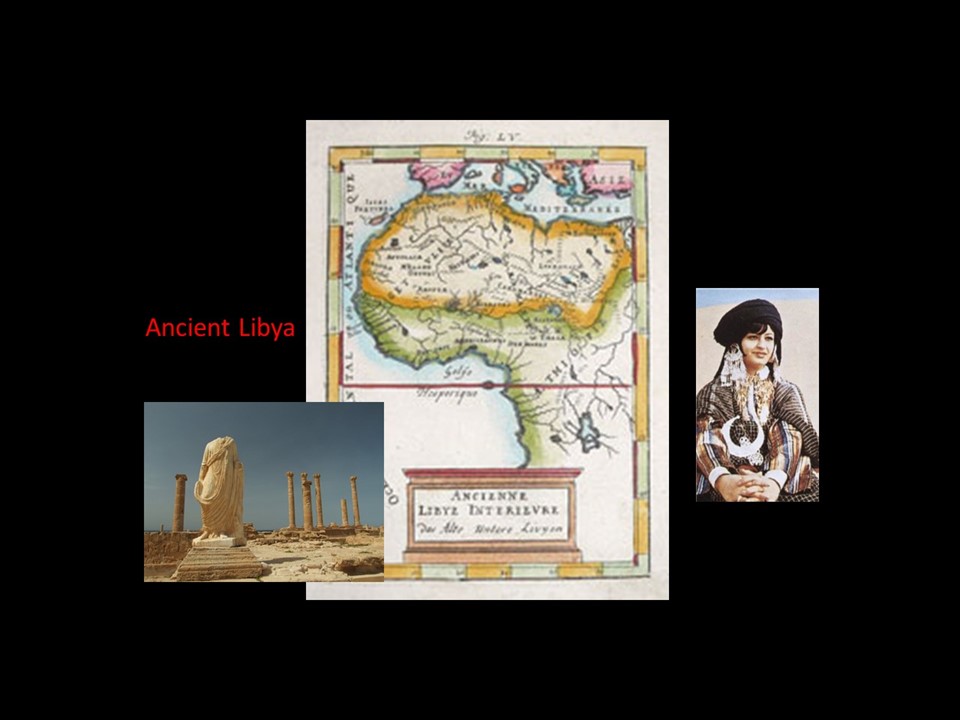
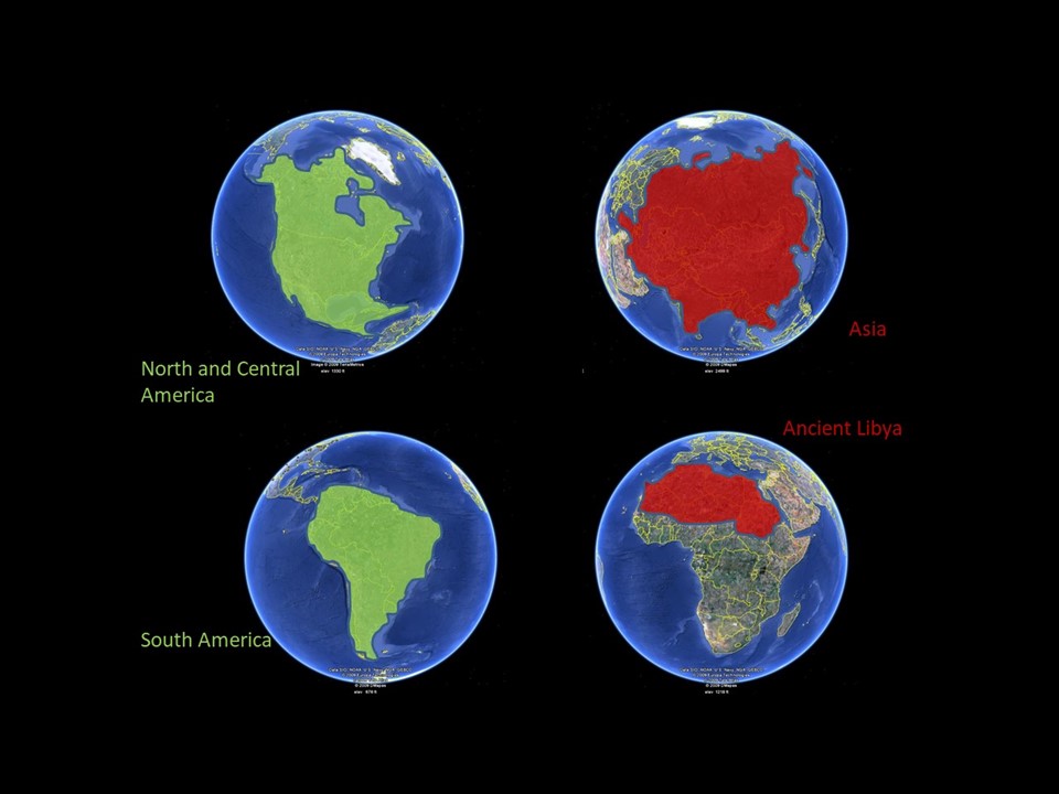
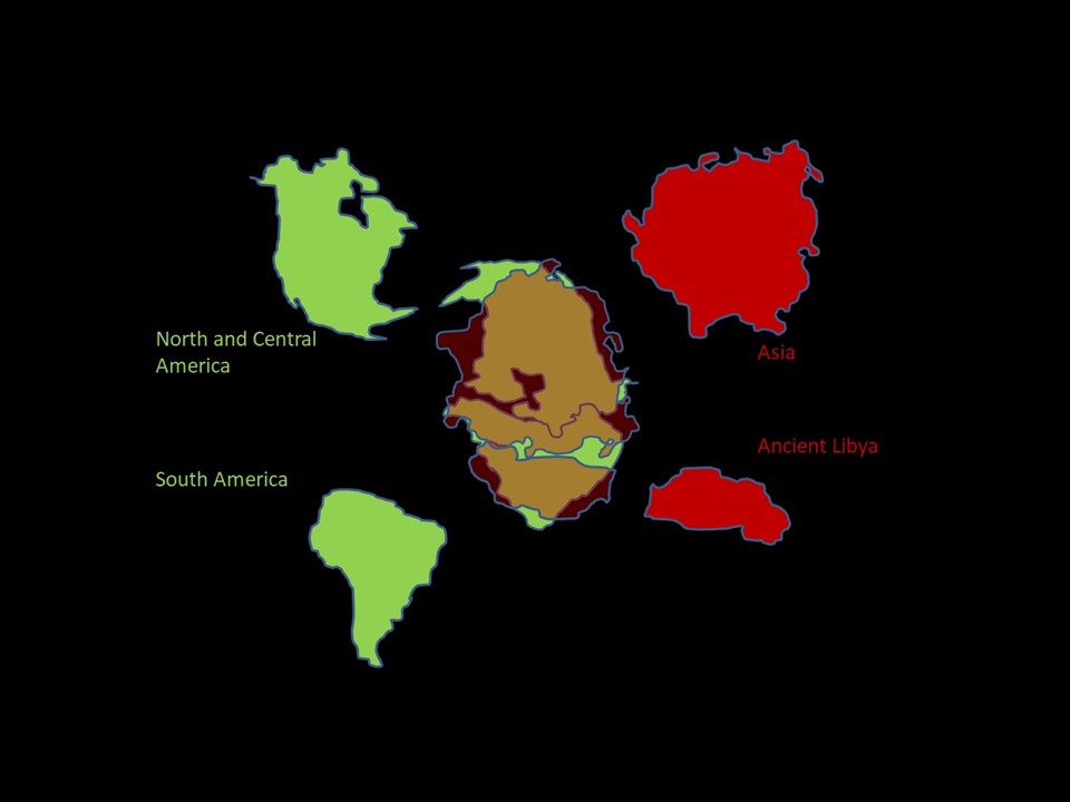
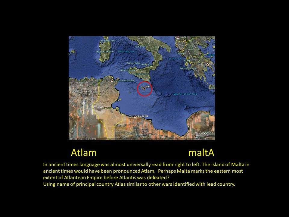
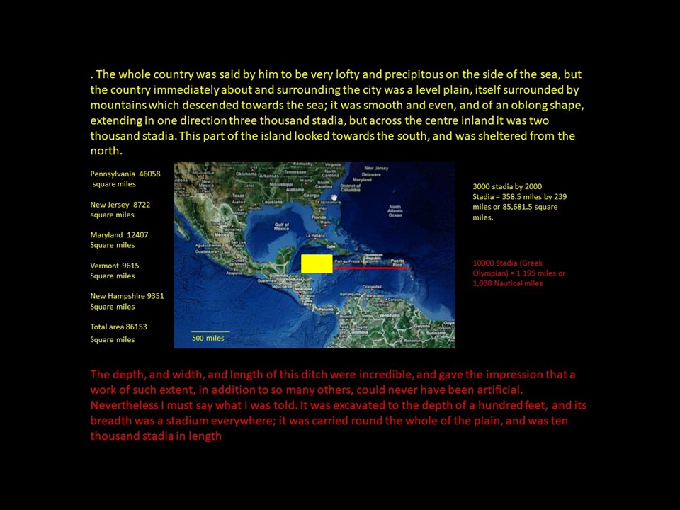
Ancient Libya covered almost two thirds of Africa. The map above shows roughly half of Africa covered. The Sahara used to be a lush land with numerous seas and abundant wildlife, easily capable of supporting a large, sprawling empire. Around 5,000 BCE Libya was pounded by a celestial disaster or a series of celestial disasters that changed their part of the world into a wasteland.A lot of strange things happened on the ground and in the sky during this time. It was not a good time to own real estate in Libya. Assuming the ancients knew the size of Asia and Libya as shown above then the comparison of two eastern landmasses with two western landmasses yields a surprising discovery. When I used the AreaCheck command on AutoCad, I discovered Asia and Ancient Libya are identical to North and South America. The accuracy is perfect when the missing lands drowned under the Gulf of Mexico and the Caribbean are added. Timaeus adds to the story of AtlantisTimeaus provides some amazing detail of Atlantis and the capitol Poseidon. I incorporated this incredible architectural backdrop into Second Sight, when Jordan accompanies Suri into the capitol and things go south fast. The more I researched for backdrop for the story, the more amazing Atlantis became. Here is where I think Poseidon was located. My mentor and colleague George Erikson believes it was on the submerged portion of the Yucatan peninsula. I think that doesn’t work because the mountains that ring the city limits and agricultural areas would be missing. I think the whole construct of the city, agricultural fields, and the surrounding mountain chains have to sink beneath the waves in order to match the account from Plato’s discussions.
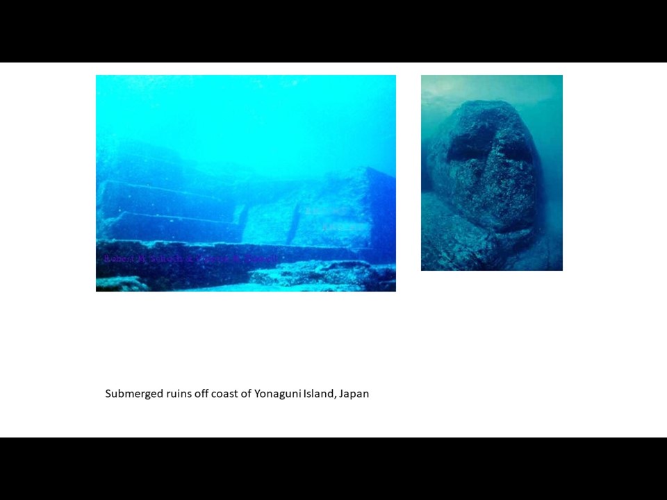
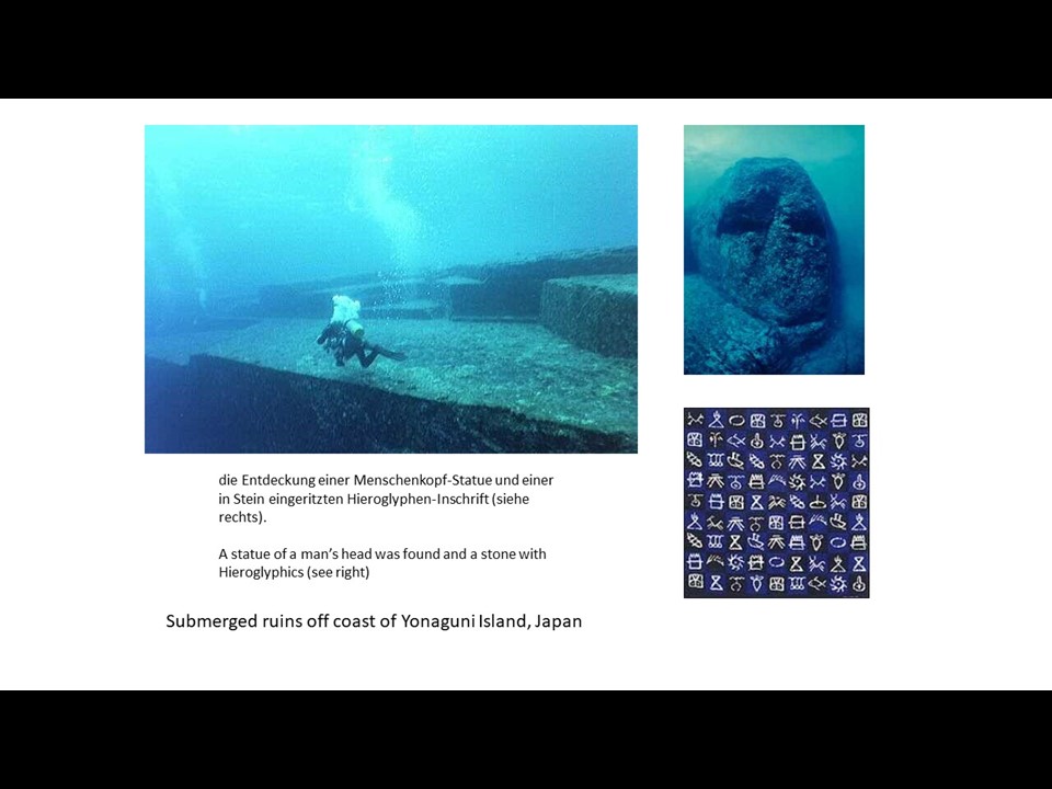
I don’t think it was here. Well maybe…Perhaps somebody reading this needs to risk twice as much money and dig in both locations. Some amazing facts that you can use at a party. Well probably not. You would probably get put in the nerd zone. Lots of submerged cities around the globe, testifying to advanced urban societies existing before the Pleistocene, the last so called Ice Age. Symbols claimed to have been found at this submerged site. I doubt that is accurate, although the carvings resemble very ancient oriental characters. They are also upside down. Where I think the ten nations of Atlantis were located. Here I placed Poseidon on the submerged portion of the Yucatan peninsula. I later changed my mind and moved it south into deeper water, under more sand. The canal graphic is accurate and would exit into the Atlantic just south of Peter Island in the BVI’s.